Engaging Getaways and Venues for:
USA/Mid-Atlantic: Greenburgh, NY
The Highlights: Twelve historic Revolutionary war sites in Greenburgh, NY and adjacent White Plains that tell important stories about America's long path to victory; a magnificent state part enabling one to experience the area as if it might have appeared in the 18th century, and multiple historic villages with excellent dining and lodging options at all price ranges. .
Other Places Nearby: New York City, Piermont, NY: The Footpath From Gotham.
Meeting and Event Options: Tarrytown, Elmsford, and White Plains offer a wide variety of options for corporate meetings, from the Opus Westchester in White Plains, the luxurious Castle Hotel & Spa and Tarrytown House Estate and Conference Center in Tarrytown to most of the major hotel chains.
Imagine a region of rolling hills bordered to the west by the grandeur of the Hudson River, dotted with forests, farmland, and small, prosperous villages. During colonial times, this would have been an ideal place to live—so much so that today it is largely settled as residential communities with thriving commercial centers, offering easy access to New York City by multiple highways and three train lines. Residents and visitors enjoy parks, hotels, restaurants, and cultural attractions, making it both a desirable place to live and a gateway to the Hudson Valley for visitors to New York City.
.jpg)
Between 1776 and the conclusion of the American Revolution, however, this was anything but a peaceful place. Following the Battle of White Plains in October 1776—where British forces defeated George Washington while allowing his army to get away—the region became a contested no man’s land. British troops held New York City and foraged and probed northward, while American forces controlled most of the Hudson River valley. Homes of loyalists and patriots alike were pillaged, civilians suffered greatly, and deadly skirmishes erupted repeatedly over the course of the war. On the banks of the Hudson, militia men set up redoubts to fire upon British trips trying to navigate the river.
The villages of the town of Greenburgh and adjacent White Plains played important roles in the story of the American Revolution. In Tarrytown, three local militia men on patrol in 1780 on what is today Broadway (Rte. 9) captured British spy Major John Andre, who against orders was carrying papers that exposed Benedict Arnold's treachery. The following summer, what is today the town of Greenburgh and its villages, including Hastings-on-Hudson, Dobbs Ferry, Irvington, Elmsford, and Hartsdale played a crucial role in the war's final phase. For here in 1781, the American and French troops first converged to begin their joint campaign against the British. Some of the area's historic locations mark where the French and American forces camped nearby one another, coordinated strategy, trained and otherwise prepared for their campaign to defeat the British.
.jpg)
The original allied plan that summer called for a difficult assault on British-held New York City. When General George Washington learned from General Rochambeau that the French fleet would instead sail to the Chesapeake Bay, the allies made a bold decision. From their location in what is now Westchester county, they would march over 400 miles to the south to Yorktown, VA, culminating in the decisive siege of Yorktown that fall and the effective end of the war.
You can discover twelve of the most important Revolutionary War locations just north of New York City in Westchester county. Most are located in the town of Greenburgh, with the notable exception of the Battle of White Plains site in the neighboring city. All sites are accessible by car, bicycle, or on foot.
Each location features a historic plaque documented in the historical marker database. Many are near parks and playgrounds, making them especially suitable for families. All lie close to Rockefeller State Park Preserve, a 1,771-acre landscape that offers a vivid sense of what much of this region looked like during colonial times. Some sites include nearby walking routes, and a complete guide to nearby hotels and restaurants is provided under the section on Dining, Lodging, Meetings, and Events.
Some of these spots merit just a short visit as much of the encampments now are on the property of a school, country club, or other private land, but together with the more scenic spots they tell an enriching day's story of three of the most momentus aspects of the Revolutionary War: the early major battle that helped Washington learn how to safely retreat to live to fight another day; the terrible often untold story of bitter conflicts between patriots and loyalists that make today's polarization seem almost quaint, and the historic convergence of the French and American forces right here in Westchester county that led to the defeat of the British in Yorktown.
To get the most authentic sense of what this region must have looked like in colonial times, visit Rockefeller State Park. With about 45 miles of bridal trails traversing nearly 1,800 acres of forest, fields, and lakes built over 100 years ago, it's as close as one can come to experiencing the land our ancestors fought, suffered, and died for.
1. Battle of White Plains
One of the earliest battles of the war in October 1776, the British forces, led by General William Howe, sought to destroy the forces of George Washington, located on Chatterton’s Hill, near the town of White Plains, a strategic location north of New York City, which was held by the British.
The British and Hessian troops, largely outnumbering the Americans, hoped to put an end to Washington’s army. Instead, Washington led a successful retreat, maintaining the army to fight another day. This established a key to Washington’s eventual success—the ability to avoid total destruction by the British despite a preponderance of early defeats.
Click here for the historic marker location.
Click here for a list of all the Revolutionary War locations in White Plains.
2) Battle of Edgar’s Lane (Hastings-on-Hudson)
This is the location of one of the bigger skirmishes in this neutral ground between NYC and our troops to the north, and one that the Americans won. It occurred on Dec. 26, 1776, the same day as Washington’s victory in Trenton.
Lee’s Legion (a Continental army light infantry unit) ambushed Hessians fighting for the British along a ravine in a small but bloody battle. They were helped by a local tavern owner, Peter Post, who assured the foragers patrolling on what today is Rte. 9 that the coast was clear. Post paid a dear price for that described in the next location.
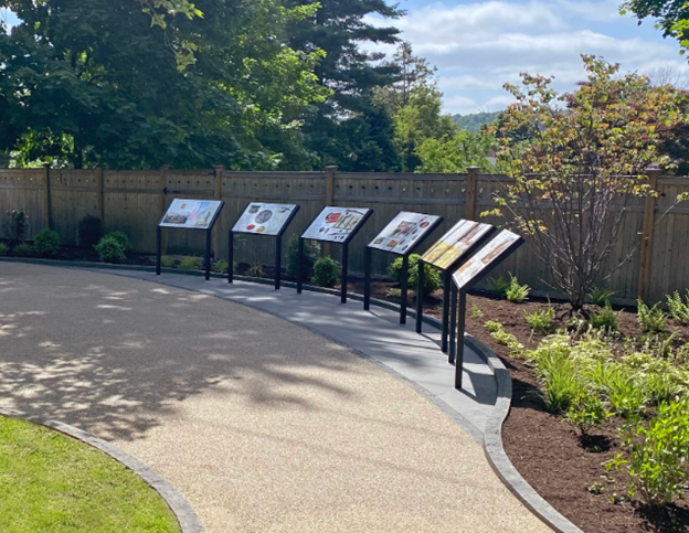
Today a set of interpretive signs—“Revolutionary Walk”—stands along Rte. 9 (the same Broadway coming north from New York City's Times Square), across a park right by the battle ground. The original state marker commemorates the fight near the junction of Broadway and Edgar’s Lane.
Click here for more information.
Easy stop: The nearby charming village of Hastings on Hudson is known for its river views, 19th century aqueduct walk and a wide variety of restaurants and other eateries. See Short Escapes, Hipsterbia by the Hudson for nearby walks and attractions.
The historical marker display is across Broadway from Zinsser Park, the location of a playground.
GPS location. 40.988902, -73.87956
3. Peter Post House

Just a few blocks south of the Battle of Edgar’s lane is the Post-Baker House at 532 Broadway, now a private home but with a prominent sign citing its origin. It was built in about 1770 by Peter Post, a Hastings on Hudson Revolutionary War hero. Although part of the story remains apocryphal, it is said that Post misled the group of foraging Hessian soldiers into thinking there were no American soldiers up the road.
The ambush succeeded at driving off the Hessian forces, another early sign of the ability of the Americans to prevail against well trained, intimidating Hessian soldiers.
Days after the battle, British forces are said to have returned to severely beat Post. He survived and ran the home as a tavern with a raucous reputation and is said to have purchased most of the land that now forms downtown Hastings-on-Hudson.
4) Capture of Major John André — Patriots’ Park (Tarrytown)

This is the site of one of the most important events in the area: where three local militiamen, John Paulding, Isaac Van Wart, and David Williams stopped Andre on Setp. 23, 1780. They found papers in Andre's boot exposing the treason of Benedict Arnold.
The Captors’ Monument (built in 1853) is among the earliest Revolutionary War memorials in the area. The adjacent park with a popular playground is on the National Register. The well-kept park features multiple plaques and statues. Click here for more information.
Besides the monument's location in a beautiful park, it is a short walk or drive from the historic villages of Tarrytown and Sleepy Hollow, the renowned Roosevelt Kykuit mansion, Old Dutch Church and magnificent Rockefeller family estate.
See Short Escapes: Pocantico Hills and Sleepy Hollow, NY, The Home of Ichabod Crane for more information and nearby walking trails.
Click here for more information.
GPS: 41° 4.905′ N, 73° 51.498′ W (Patriots’ Park, US Rt. 9).
5) Odell House — Rochambeau’s Headquarters (Hartsdale)
.jpg)
The French commander Comte de Rochambeau headquartered here July–August 1781 during the march from Rhode Island to Yorktown that led to the final battle of the war that fall. The farmhouse became the center of the Franco-American encampment that coordinated with Washington.
The house, currently under major reconstruction set to re-open as a small museum in time for a 250th anniversary, preserves 18th-century architecture and is on the National Register.
Trails (known as the Rochambeau Ramble) connect the property to surrounding parkland in areas once occupied by French and American troops. Located near the “four-corners” of Hartsdale and nearby village, there is a wide variety of restaurants, sandwich shops, and other amenities.
Click here for more information and news about when the restored house will reopen.
Location: 41° 1′ 9.296″ N, 73° 49′ 5.215″ W (425 Ridge Rd, Hartsdale, NY.)
6) American Encampment — (Located on the Campus of Ardsley High School at Heatherdell Road, Ardsley)
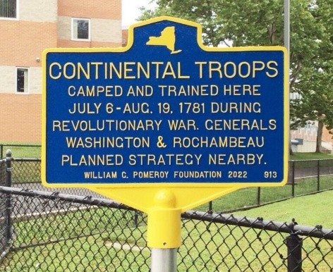
More than 4,000 Continentals camped and trained here July 6 to Aug. 19, 1781 where young people now learn and play. It is set along the old “Military Road,” today’s Heatherdell Road, on the long route from Rhode Island to Yorktown, VA. The activities here at the time were directly tied to preparations for the Virginia campaign.
It is located close to the Odell house, also along the Military Road, and just a short drive away from the village of Ardsley, with a variety of restaurants and other coffee and food shops. There’s a playground on the school grounds.
Click here for more information.
7) “French Camp” — Edgemont/Dobbs Ferry Area (Underhill Rd & Clayton St.)
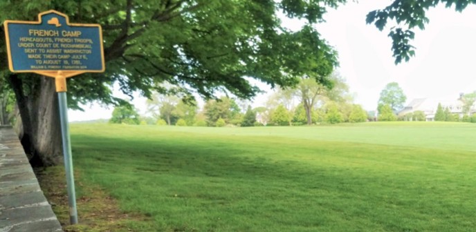
The French and Americans worked and trained in different camps that summar strong along a road running east-west through the county on what would become the journey to Yorktown. The marker notes the allied French encampment east of the American lines, July through August 1781. The location was chosen to watch British-held Manhattan just 12 miles south. It was part of the broader Washington–Rochambeau encampment extending across Greenburgh. It sits near modern Sunningdale Country Club area on Underhill Road. It's a good stop to understand the encampment’s east-west layout--the French largely east of Sprain Brook parkway. The location is near to multiple dining and other options on Central Avenue in Hartsdale or in the village of Ardsley.
Location: 41.008433, -73.820983, Underhill and Clayton Road, Scarsdale, NY
Click here for more information.
8) Willow Point — Site of a Ferry Used During Revolutionary War Times
This is the location where the Dobbs family’s ferry began operating in about 1698—creating the name of the village of Dobbs Ferry. It connects the east shore of the Hudson river to the New Jersey side on the west. There is a small opening in the Palisades cliffs across the river through which troops could march. Willows Point is now a park.
It was a strategic Hudson River landing throughout the war but the main crossing for the march to Yorktown was further north. This crossing was deemed too dangerous given its location near New York City held by the British. It would also make it more likely for the British to discover the march to Yorktown. The location is near the sites of the 1781 allied encampments and observation points overlooking the river.
The public park has riverfront views and adjacent restaurants both with river views.
Click here for more information. Click here for marker location.
Dobbs Ferry and surrounding villages of Hastings on Hudson and Irvington offer numerous restaurants and other amenities and is located near the Metro North railroad station. See Short Escapes: Hipsturbia on the Hudson.
GPS: 41° 0′ 54.3″ N, 73° 52′ 41.8″ W (Waterfront Park)
9) Continental/French Encampment — Dobbs Ferry
During the war, Dobbs Ferry was the location of an encampment that stretched from the Hudson shore (Dobbs Ferry) east through Ardsley and Hartsdale. More were set up north along the east shore of the Hudson. Residential homes and the village long ago replaced the redoubts. During July–August 1781, the joint encampments included redoubts on the bluffs above Dobbs Ferry. The original plan called for these troops to be part of the attack on New York City to win the war.
Instead, most marched north to cross the river on the long journey to Yorktown, rather than crossing the river at the local ferry that gave the town its name. Located close to New York City, Dobbs Ferry was too prone to discovery or disruption by local British forces, and there was no desire to draw attention to the new plans to march upon Yorktown instead of attacking New York. Instead, they marched north for the main crossing at Stony Point.
Dobbs Ferry and neighboring Hastings on Hudson and Irvington offer an excellence section of cafes and other amenities.
See Short Escapes: Hipsturbia on the Hudson.
Location: 152 Broadway, Dobbs Ferry, NY 10522 (corner of Broadway and Colonial Avenues.
Latitude: 41.0086° N; Longitude: -73.8786° W
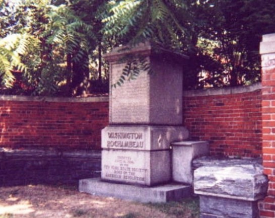
10) Isaac Van Wart Grave and Monument (Elmsford)
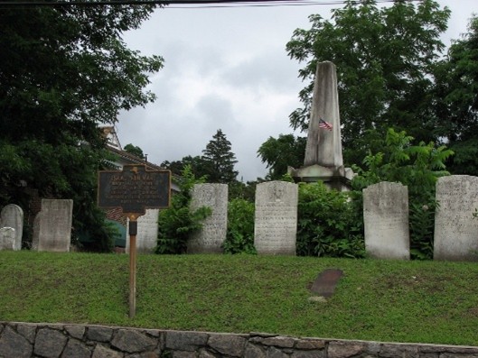
Van Wart was one of the three John André captors honored at Patriots’ Park in Tarrytown. He is honored with a prominent monument with the notable epitaph: “FIDELITY”. The 1793 church and burying ground include other revolutionary war veterans. Westchester County honored Van Wart and his comrades after the war.
Elmsford has a variety of hotels, restaurants, cafes, and other attractions.
Click here for gravesite info. Click here for more information about Isaac Van Wart.
Located at Elmsford Reformed Church and Cemetery.
GPS: ~41.053523, −73.820681 (30 S. Central Ave, Elmsford.)
11) Earth Redoubt Location — Tarrytown waterfront bluffs
This is the site of an American water-guard position overlooking the Hudson. The site was used to fire on HMS Vulture carrying John André and the traitor Benedict Arnold after a rendezvous between the two men. It was part of the chain of fortifications on the Hudson protecting the ferry and river traffic. It is the location of one of the many river batteries set up to control movements along the Hudson.
Location. Foot of Church Street, Tarrytown, marking an American water-guard position overlooking the Hudson. Click here for more information.
See Short Escapes: Pocantico Hills and Sleepy Hollow, NY, The Home of Ichabod Crane for more information on the area and nearby walking trails.
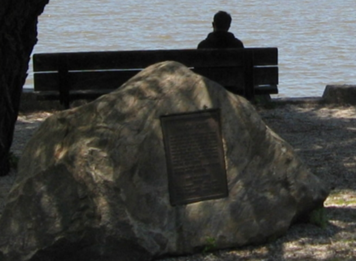
12) John Dean’s Rock (Greenburgh)
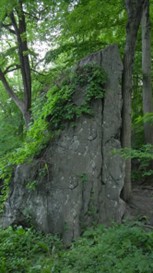 A local patriot Captain John Dean used a large rock here as a refuge in raids and counterraids in the neutral ground between the British in New York City and American forces to the north. The rock evokes the guerrilla-style fighting typical of Westchester’s borderlands. It is located on the scenic North County Trailway along the route of an abandoned railroad.
The nearby village of Hawthorne features many restaurants, amenities, and old graveyards.
Note: This location is not available by car. You must access it by the North County paved rail-trail that parallels the Saw Mill River parkway. From Elmsford, head north on the parkway toward the Eastview exit, where you can park and walk or ride your bike north on the trail. As you approach the Hawthorne highway interchange area to your right, look to the east side of the trail (your right when heading north). The marker sits by the John Dean rock outcrop along the parkway embankment just south of the interchange. (Photo by Philip Hayes Sr.)
Click here for the Google map location.
See Short Escapes: Pocantico Hills and Sleepy Hollow, NY, The Home of Ichabod Crane for more information and nearby walking trails in the Rockefeller State Park.